Tuesday, 15 October 2013

Worlds Top 5 Highest Mountains

1 comment


MOUNT EVERST

Mount Everst Worlds highest mountain


Source: Yashra/Flickr


Mount Everest (Tibetan/Sherpa: ཇོ་མོ་གླང་མ, Chomolungma; Chinese: 珠穆朗玛峰, Zhūmùlǎngmǎ Fēng;Nepali: सगरमाथा, Sagarmāthā) is the Earth's highest mountain, with a peak at 8,848 metres (29,029 ft) above sea level and the 5th tallest mountain measured from the centre of the Earth. It is located in the Mahalangur section of the Himalayas. The international border between China and Nepal runs across the precise summit point. Its massif includes neighboring peaks Lhotse, 8,516 m (27,940 ft); Nuptse, 7,855 m (25,771 ft) and Changtse, 7,580 m (24,870 ft).
In 1856, the Great Trigonometric Survey of British India established the first published height of Everest, then known as Peak XV, at 29,002 ft (8,840 m). The current official height of 8,848 m (29,029 ft) as recognized by Nepal and China was established by a 1955 Indian survey and subsequently confirmed by a Chinese survey in 1975. In 1865, Everest was given its official English name by the Royal Geographical Society upon a recommendation by Andrew Waugh, the British Surveyor General of India. Waugh named the mountain after his predecessor in the post, Sir George Everest. Although Tibetans had called Everest "Chomolungma" for centuries, Waugh was unaware of this because Tibet and Nepal were closed to foreigners at the time thus preventing any attempts to obtain local names.

Mount Everest attracts many highly experienced mountaineers as well as capable climbers willing to hire professional guides. There are two main climbing routes, one approaching the summit from the southeast in Nepal (known as the standard route) and the other from the north in Tibet. While not posing substantial technical climbing challenges on the standard route, Everest presents dangers such as altitude sickness, weather, wind as well as significant objective hazards from avalanches and the Khumbu Icefall. While the overwhelming majority of climbers will use bottled oxygen in order to reach the top, some climbers have summitted Everest without supplemental oxygen.

Source: Wikipedia


K2

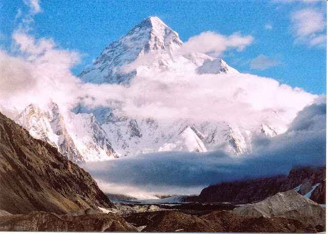
K2 Worlds secong highest cliff


K2 (also known as Chhogori/Qogir, Ketu/Kechu, and Mount Godwin-Austen) is the second-highest mountain on Earth, after Mount Everest. It is located on the border between Baltistan, in the Gilgit–Baltistan region of northern Pakistan, and the Taxkorgan Tajik Autonomous County of Xinjiang, China. With a peak elevation of 8,611 m (28,251 feet), K2 is the highest point of the Karakoram Range and the highest point in Pakistan.
K2 is known as the Savage Mountain due to the extreme difficulty of ascent and the second-highest fatality rate among the eight thousanders. For every four people who have reached the summit, one has died trying. It is more hazardous to reach K2 from the Chinese side; thus, it is mostly climbed from the Pakistani side. Unlike Annapurna, the mountain with the highest fatality-to-summit rate, K2 has never been climbed in winter.

Source: Wikipedia


KANGCHENJUNGA

Kanchenjunga Worlds third highest mountain


Kangchenjunga is the third highest mountain in the world. It rises with an elevation of 8,586 m (28,169 ft) in a section of the Himalayas called Kangchenjunga Himal that is limited in the west by the Tamur River and in the east by the Teesta River. Kangchenjunga is located on the boundary between Nepal and the Indian state of Sikkim.
The Geological Survey of India indicates the summit of Kangchenjunga at 8,598 m (28,209 ft). It is the highest peak in India and the easternmost of the peaks higher than 8,000 m (26,000 ft). It is called Five Treasures of Snow after its five high peaks, and has always been worshiped by the people of Darjeeling and Sikkim.
Two of the five peaks are in Taplejung District, Nepal. The other three peaks – main, central, and south – are on the border of North Sikkim and Nepal.
Until 1852, Kangchenjunga was assumed to be the highest mountain in the world, but calculations based on various readings and measurements made by the Great Trigonometric Survey of India in 1849 came to the conclusion that Mount Everest, known as Peak XV at the time, was the highest. Allowing for further verification of all calculations, it was officially announced in 1856 that Kangchenjunga is the third-highest mountain.

Source: Wikipedia


MOUNT KAİLASH

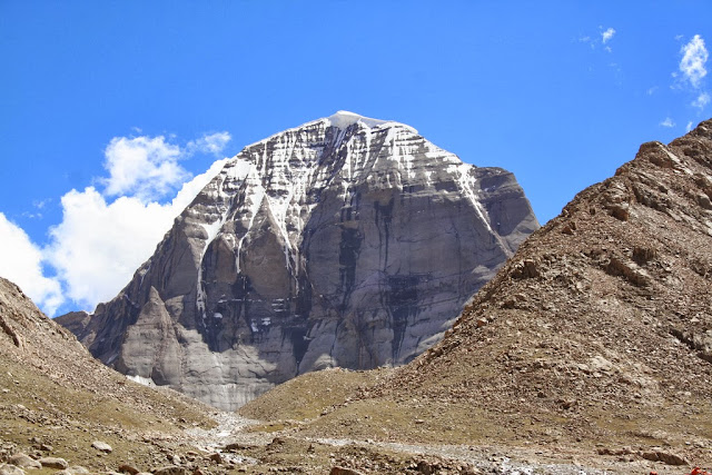
Mount Kailash worlds fourth highest cliff


Mount Kailash (also Mount Kailas; (Tibetan: གངས་རིན་པོ་ཆེ,Sanskrit: कैलाश् Kangrinboqê or Gang Rinpoche; simplified Chinese: 冈仁波齐峰, Gāngrénbōqí fēng) is a peak in the Kailas Range (Gangdisê Mountains), which are part of the Transhimalaya in Tibet. It lies near the source of some of the longest rivers in Asia: the Indus River, the Sutlej River (a major tributary of the Indus River), the Brahmaputra River, and the Karnali River (a tributary of the River Ganga). It is considered a sacred place in four religions: Bön, Buddhism, Hinduism and Jainism. The mountain lies near Lake Manassarovar and Lake Rakshastal in Tibet.

Source: Wikipedia


MANASLU

Manaslu Worlds fifth highest cliff


Manaslu (Nepali: मनास्लु), also known as Kutang) is the eighth highest mountain in the world, and is located in the Mansiri Himal, part of the Nepalese Himalayas, in the west-central part of Nepal. Its name, which means "Mountain of the Spirit", comes from the Sanskrit word Manasa, meaning "intellect" or "soul". Manaslu was first climbed on May 9, 1956 by Toshio Imanishi and Gyalzen Norbu, members of a Japanese expedition. It is said that "just as the British consider Everest their mountain, Manaslu has always been a Japanese mountain".
Manaslu at 8,156 metres (26,759 ft) above mean sea level (m.s.l) is the highest peak in the Lamjung District and is located about forty miles east of Annapurna. The mountain's long ridges and valley glaciers offer feasible approaches from all directions, and culminate in a peak that towers steeply above its surrounding landscape, and is a dominant feature when viewed from afar.

Source: Wikipedia


Read More...

Monday, 14 October 2013

Most Beautiful Touristic Places In Istanbul Turkey

Leave a Comment
TOPKAPI PALACE


One of the most historic palaces


Source: Hector Juan/Flickr

The Topkapı Palace (Turkish: Topkapı Sarayı or in Ottoman Turkish: طوپقپو سرايى) is a large palace in Istanbul, Turkey, that was the primary residence of the Ottoman Sultans for approximately 400 years (1465-1856) of their 624-year reign.
As well as a royal residence, the palace was a setting for state occasions and royal entertainments. It is now a major tourist attraction and contains important holy relics of the Muslim world, including Muhammed's cloak and sword. The Topkapı Palace is among the monuments contained within the "Historic Areas of Istanbul", which became a UNESCO World Heritage Site in 1985, and is described under UNESCO's criterion iv as "the best example of ensembles of palaces of the Ottoman period."
The palace complex consists of four main courtyards and many smaller buildings. At its peak, the palace was home to as many as 4,000 people, and covered a large area with a long shoreline. It contained mosques, a hospital, bakeries, and a mint. Construction began in 1459, ordered by Sultan Mehmed II, the conqueror of Byzantine Constantinople. It was originally called the New Palace (Yeni Sarayı) to distinguish it from the previous residence. It received the name "Topkapı" (Cannon Gate) in the 19th century, after a (now lost) gate and shore pavilion. The complex was expanded over the centuries, with major renovations after the 1509 earthquake and the 1665 fire.
After the 17th century the Topkapı Palace gradually lost its importance as the sultans preferred to spend more time in their new palaces along the Bosporus. In 1856, Sultan Abdül Mecid I decided to move the court to the newly built Dolmabahçe Palace, the first European-style palace in the city. Some functions, such as the imperial treasury, the library, and the mint, were retained in the Topkapı Palace.

Source: Wikipedia


HAGİA SOPHİA

A historic meuseum Hagia Sophia in Istanbul


Hagia Sophia (from the Greek: Ἁγία Σοφία, "Holy Wisdom"; Latin: Sancta Sophia or Sancta Sapientia; Turkish: Ayasofya) is a former Greek Orthodox patriarchal basilica (church), later an imperial mosque, and now a museum in Istanbul, Turkey. From the date of its construction in 537 until 1453, it served as an Eastern Orthodox cathedral and seat of the Patriarchate of Constantinople, except between 1204 and 1261, when it was converted to a Roman Catholic cathedral under the Latin Empire. The building was a mosque from 29 May 1453 until 1931. It was then secularized and opened as a museum on 1 February 1935.

The Church was dedicated to the Wisdom of God, the Logos, the second person of the Holy Trinity, its patronal feast taking place on 25 December, the commemoration of the Birth of the incarnation of the Logos in Christ. Although sometimes referred to as Sancta Sophia (as though it were named after Saint Sophia), sophia being the phonetic spelling in Latin of the Greek word for wisdom, its full name in Greek is Ναός τῆς Ἁγίας τοῦ Θεοῦ Σοφίας, "Shrine of the Holy Wisdom of God". Famous in particular for its massive dome, it is considered the epitome of Byzantine architecture and is said to have "changed the history of architecture." It remained the world's largest cathedral for nearly a thousand years thereafter, until Seville Cathedral was completed in 1520. The current building was originally constructed as a church between 532 and 537 on the orders of the Byzantine Emperor Justinian and was the third Church of the Holy Wisdom to occupy the site, the previous two having both been destroyed by rioters. It was designed by the Greek scientists Isidore of Miletus, a physicist, and Anthemius of Tralles, a mathematician.

The church contained a large collection of holy relics and featured, among other things, a 15-metre (49 ft) silver iconostasis. The focal point of the Eastern Orthodox Church for nearly one thousand years, the building witnessed the excommunication of Patriarch Michael I Cerularius on the part of Pope Leo IX in 1054, an act which is commonly considered the start of the Great Schism.

Source: Wikipedia


GALATA TOWER

Galata Tower in one of the historic places in Istanbul


The Galata Tower (Galata Kulesi in Turkish) — called Christea Turris (the Tower of Christ in Latin) by the Genoese — is a medieval stone tower in the Galata/Karaköy quarter of Istanbul, Turkey, just to the north of the Golden Horn. One of the city's most striking landmarks, it is a high, cone-capped cylinder that dominates the skyline and offers a panoramic vista of Old Istanbul or Constantinople and its environs.
The nine-story tower is 66.90 meters tall (62.59 m without the ornament on top, 51.65 m at the observation deck), and was the city's tallest structure when it was built. The elevation at ground level is 35 meters above sea-level. The tower has an external diameter of 16.45 meters at the base, an 8.95 meters diameter inside, and walls that are 3.75 meters thick.
There is a restaurant and café on its upper floors which command a magnificent view of Istanbul and the Bosphorus. Also located on the upper floors is a night club which hosts a Turkish show. There are two operating elevators that carry visitors from the lower level to the upper levels.

Source: Wikipedia


GRAND BAZAR

Grand Bazar a historic place in Istanbul containing more than 4000 shops


The Grand Bazaar (Turkish: Kapalıçarşı, meaning "Covered Bazaar"; also: Turkish: Büyük Çarşı, meaning "Grand Bazaar" ) in Istanbul is one of the largest and oldest covered markets in the world, with 61 covered streets and over 3,000 shops  which attract between 250,000 and 400,000 visitors daily.

The Grand Bazaar is located inside the walled city of Istanbul, in the district of Fatih and in the neighbourhood (Turkish: Mahalle) bearing the same name ("Kapalıçarşı"). It stretches roughly from west to east between the mosques of Beyazit and of Nuruosmaniye. The Bazaar can easily be reached from Sultanahmet and Sirkeci by trams ( Line "T1", tram stop "Beyazıt-Kapalıçarşı").

Source: Wikipedia


DOLMABAHÇE PALACE

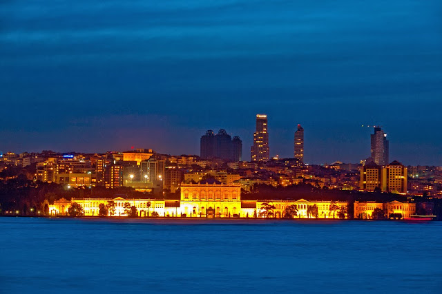
Dolmabahçe palace a luxury piece of architecture


Dolmabahçe Palace (Turkish: Dolmabahçe Sarayı, IPA: [doɫmabahˈtʃe saɾaˈjɯ]) located in the Beşiktaş district of Istanbul, Turkey, on the European coastline of the Bosphorus strait, served as the main administrative center of the Ottoman Empire from 1856 to 1922, apart from a 22-year interval (1887–1909) in which Yıldız Palace was used.
Dolmabahçe Palace was ordered by the Empire's 31st Sultan, Abdülmecid I, and built between the years 1843 and 1856. Hacı Said Ağa was responsible for the construction works, while the project was realized by architects Garabet Balyan, his son Nigoğayos Balyan and Evanis Kalfa (members of the Balyan family of Ottoman court architects.) The construction cost five million Ottoman mecidiye gold coins, the equivalent of 35 tonnes of gold. Fourteen tonnes of gold in the form of gold leaf were used to gild the ceilings of the 45,000 square metre monoblock palace, which stands on an area of 110,000 m².


Source: Wikipedia


FATİH MOSQUE

Fatih Mosque the most visited place by tourists in Istanbul


Fatih mosque the most visited place by tourists in Istanbul


he Fatih Mosque (Turkish: 'Fatih Camii' or Conqueror's Mosque in English) is an Ottoman imperial mosque located in the Fatih district of Istanbul, Turkey. It was one of the largest examples of Turkish-Islamic architecture in Istanbul and represented an important stage in the development of classic Turkish architecture. It is named after Fatih Sultan Mehmed, the Ottoman sultan who captured Constantinople in 1453.
The Fatih mosque complex was a religious and social building of unprecedented size and complexity built in Istanbul between 1463-1470 by the order of Fatih Sultan Mehmed, on the site of the former Byzantine Church of the Holy Apostles, which had been a ruin since the Fourth Crusade. It was built by the royal architect Atik Sinan. The Fatih mosque was the first monumental project in the Ottoman imperial architectural tradition.

Source: Wikipedia


Read More...

Top 5 Marvellous Hotels İn Dubai

1 comment

JUMEIRAH BEACH HOTEL

Jumeirah Beach Hotel, the most luxurios one


Source: Tropical Sky/Flickr

Jumeirah Beach Hotel is a hotel in Dubai, United Arab Emirates. The hotel, which opened in 1997, is operated by the Dubai-based hotelierJumeirah. The hotel contains 598 rooms and suites, 19 beachfront villas, and 20 restaurants and bars. This wave-shaped hotel complements the sail-shaped Burj Al Arab, which is adjacent to the Jumeirah Beach Hotel.

The hotel occupies a location on the beach. Visitors to the hotel have at total of 33,800 square metres (364,000 sq ft) of beach for their use.Beside the hotel is the Wild Wadi Water Park. All guests in the hotel have unlimited access to the waterpark.

The beachfront area where the Burj Al Arab and Jumeirah Beach Hotel are located was previously called Chicago Beach. The hotel is located on an island of reclaimed land offshore of the beach of the former Chicago Beach Hotel. The locale's name had its origins in the Chicago Bridge & Iron Company which at one time welded giant floating oil storage tankers on the site.

The old name persisted after the old Hotel was demolished in 1997 since Dubai Chicago Beach Hotel was the Public Project Name for the construction phase of the Burj Al Arab Hotel until Sheikh Mohammed bin Rashid Al Maktoum announced the new name.When completed in 1997, the Jumeirah Beach Hotel was 93 metres high making it the 9th tallest building in Dubai. Today, it is ranked lower than the 100th tallest building. Despite its lower rankings, the hotel remains a Dubai landmark.

Source: Wikipedia


THE MEYDAN HOTEL

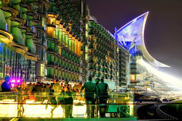
One of the top 5 star hoels of Dubai ''The Meydan Hotel''


Source: Mark McCarthy/Flickr


Jumeirah Beach Hotel is a hotel in Dubai, United Arab Emirates. The hotel, which opened in 1997, is operated by the Dubai-based hotelier Jumeirah. The hotel contains 598 rooms and suites, 19 beachfront villas, and 20 restaurants and bars. This wave-shaped hotel complements the sail-shaped Burj Al Arab, which is adjacent to the Jumeirah Beach Hotel.
The hotel occupies a location on the beach. Visitors to the hotel have at total of 33,800 square metres (364,000 sq ft) of beach for their use. Beside the hotel is the Wild Wadi Water Park. All guests in the hotel have unlimited access to the waterpark.
The beachfront area where the Burj Al Arab and Jumeirah Beach Hotel are located was previously called Chicago Beach. The hotel is located on an island of reclaimed land offshore of the beach of the former Chicago Beach Hotel. The locale's name had its origins in the Chicago Bridge & Iron Company which at one time welded giant floating oil storage tankers on the site.
The old name persisted after the old Hotel was demolished in 1997 since Dubai Chicago Beach Hotel was the Public Project Name for the construction phase of the Burj Al Arab Hotel until Sheikh Mohammed bin Rashid Al Maktoum announced the new name.
When completed in 1997, the Jumeirah Beach Hotel was 93 metres high making it the 9th tallest building in Dubai. Today, it is ranked lower than the 100th tallest building. Despite its lower rankings, the hotel remains a Dubai landmark.


Source: Wikipedia


RAFFLES DUBAİ

One of the most awesome hotels of the Raffles Dubai


Raffles Dubai is a 19-storey hotel that is built in the shape of a pyramid. The design was an inspiration taken from traditional Egyptian architecture. It is located at the Wafi food and entertainment complex, 15 minutes away from the Dubai International Airport.

Raffles Dubai was built by the Wafi Group, a Dubai-based diversified business conglomerate that invested more than 140 million US dollars on its first hotel project. The Wafi group entered into an agreement where the hotel would be managed and operated by the Singapore based hospitality chain Raffles Hotels and Resorts. The agreement also marked Raffles’ entry into the Middle East and expanded its presence to 41 hotels in 35 destinations.

The hotel’s signature pyramid shape was conceived by architect Bryn Lummus and developed locally by lead architects Arif & Bin Toak. The interior of the hotel was designed by the Dubai-based LW Design group. Construction began in April 2005 and the hotel began its operations in 2007.
The Raffles Dubai is noteworthy as it is the first Raffles hotel to be newly built, as most hotels operated by the company are mostly buildings with historical importance which were bought over by Raffles Hotels and Resort.

Source: Wikipedia


 Atlantis The Palm Dubai

Atlantis, The Palm is a resort located on Dubai’s reclaimed artificial island The Palm. It was the first resort to be built on the island and is based on the myth of Atlantis  includes distinct Arabian elements. The resort opened on September 24, 2008 as a joint venture between Kerzner International Holdings Limited and Istithmar.
The resort has two accommodation wings, also referred to as the Royal Towers, consisting of the East and the West Tower, both linked together by the Royal Bridge Suite. The resort’s comprises 1,500 guestrooms and suites with private balconies and views over The Palm and the Persian Gulf. The Imperial Club has over 150 rooms and suites with exclusive services and a private club lounge and views of the Arabian Sea or The Palm and Dubai skyline.
The Royal Bridge Suite, spanning the Royal Towers, is 22 stories up with views of The Palm, Dubai and the Persian Gulf. The two Underwater Suites are each three stories high with views directly into the Ambassador Lagoon.

Source: Wikipedia


MARİNA DUBAİ

Dubai Maria a dream land


Dubai Marina (Arabic: مرسى دبي‎) is a district in Dubai, United Arab Emirates. Dubai Marina is an artificial canal city, built along a two mile (3 km) stretch of Persian Gulf shoreline. When the entire development is complete, it will accommodate more than 120,000 people in residential towers and villas. It is located on Interchange 5 between Jebel Ali Port and the area which hosts Dubai Internet City, Dubai Media City, and the American University in Dubai. The first phase of this project has been completed. Dubai Marina was inspired by the Concord Pacific Place development along False Creek in Vancouver, BC, Canada. Dubai Marina is also one of the few places in Dubai where people from Western Europe form a majority.

Source: Wikipedia
Read More...

Saturday, 12 October 2013

Dubai a city which never sleeps 24/7

Leave a Comment
Dubai a city worth to see before death

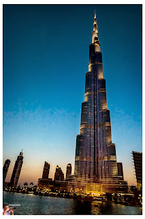
Burj al khalifa
                                                                           
The glorious Burj al khalifa


Source: Randy Naramroff/Flickr

Burj Khalifa (Arabic: برج خليفة‎, "Khalifa tower"), known as Burj Dubai prior to its inauguration, is a skyscraper in Dubai, United Arab Emirates, and is the tallest man-made structure in the world, at 829.8 m (2,722 ft).

Construction began on 21 September 2004, with the exterior of the structure completed on 1 October 2009. The building officially opened on 4 January 2010, and is part of the new 2 km2 (490-acre) development called Downtown Dubai at the 'First Interchange' along Sheikh Zayed Road, near Dubai's main business district. The tower's architecture and engineering were performed by Skidmore, Owings and Merrill of Chicago, with Adrian Smith as chief architect, and Bill Baker as chief structural engineer.The primary contractor was Samsung C&T of South Korea.

In March 2009, Mohamed Ali Alabbar, chairman of the project's developer, Emaar Properties, said office space pricing at Burj Khalifa reached US$4,000 per sq ft (over US$43,000 per m²) and the Armani Residences, also in Burj Khalifa, sold for US$3,500 per sq ft (over US$37,500 per m²). He estimated the total cost for the project to be about US$1.5 billion.

The project's completion coincided with the global financial crisis of 2007–2012, and with vast overbuilding in the country; this led to high vacancies and foreclosures. With Dubai mired in debt from its huge ambitions, the government was forced to seek multibillion dollar bailouts from its oil-rich neighbor Abu Dhabi. Subsequently, in a surprise move at its opening ceremony, the tower was renamed Burj Khalifa, said to honour the UAE President Khalifa bin Zayed Al Nahyan for his crucial support.


Because of the slumping demand in Dubai's property market, the rents in the Burj Khalifa plummeted 40% some ten months after its opening. Out of 900 apartments in the tower, 825 were still empty at that time. However, over the next two and a half years, overseas investors steadily began to purchase the available apartments and office space in Burj Khalifa. By October 2012, Emaar reported that around 80% of the apartments were occupied.


Burj al arab

Evening view of burj al arab


Source: Bryan Adams/Flickr


The beachfront area where Burj Al Arab and Jumeirah Beach Hotel are located was previously called Chicago Beach. The hotel is located on an island of reclaimed land 280 meters offshore of the beach of the former Chicago Beach Hotel. The locale's name had its origins in the Chicago Bridge & Iron Company which at one time welded giant floating oil storage tankers on the site.
The old name persisted after old Hotel was demolished in 1997. Dubai Chicago Beach Hotel remained as the Public Project Name for the construction phase of Burj Al Arab Hotel until Sheikh Mohammed bin Rashid Al Maktoum announced the new name.
Design and construction

Design and Construction
Burj Al Arab was designed by architect Tom Wright of Atkins. The design and construction were managed by Canadian engineer Rick Gregory also of WS Atkins. Construction of the Island began in 1994. It was built to resemble the sail of a dhow, a type of Arabian vessel. Two "wings" spread in a V to form a vast "mast", while the space between them is enclosed in a massive atrium. The architect Tom Wright said "The client wanted a building that would become an iconic or symbolic statement for Dubai; this is very similar to Sydney with its Opera House, London with Big Ben, or Paris with the Eiffel Tower. It needed to be a building that would become synonymous with the name of the country."

The architect and engineering consultant for the project was Atkins. Fletcher Construction from New Zealand was the lead joint venture partner in the initial stages of pre-construction and construction. The hotel was built by South African construction contractor Murray & Roberts and Al Habtoor Engineering.The building opened in December 1999.There was a considerable controversy regarding the claim that the structure looks like a huge Christian cross.

Features
Several features of the hotel required complex engineering feats to achieve. The hotel rests on an artificial island constructed 280 m (920 ft) offshore. To secure a foundation, the builders drove 230 forty-meter (130 ft) long concrete piles into the sand.

Engineers created a ground/surface layer of large rocks, which is circled with a concrete honeycomb pattern, which serves to protect the foundation from erosion. It took three years to reclaim the land from the sea, while it took fewer than three years to construct the building itself. The building contains over 70,000 m3 (92,000 cu yd) of concrete and 9,000 tons of steel.Inside the building, the atrium is 180 m (590 ft) tall.Burj Al Arab is the world's fourth tallest hotel (not including buildings with mixed use). The structure of the Rose Rayhaan, also in Dubai, is 11 m (36 ft) taller than Burj Al Arab.

Rooms and suites
The hotel is managed by the Jumeirah Group. Despite its size, Burj Al Arab holds only 28 double-story floors which accommodate 202 bedroom suites. The smallest suite occupies an area of 169 m2 (1,820 sq ft), the largest covers 780 m2 (8,400 sq ft).
Suites feature design details that juxtapose east and west. White columns show great influence.[clarification needed] Bathrooms are accented by mosaic tile patterns.[citation needed]
The Royal Suite, billed at US$18,776 per night, is listed at number 12 on World's 15 most expensive hotel suites compiled by CNN Go in 2012
The Burj Al Arab is very popular with the Chinese market, which made up 25 per cent of all bookings at the hotel in 2011 and 2012.

Restaurants
Al Muntaha (Arabic for "Highest" or "Ultimate"), is located 200 m (660 ft) above the Persian Gulf, offering a view of Dubai. It is supported by a full cantilever that extends 27 m (89 ft) from either side of the mast, and is accessed to a panoramic elevator.


Worlds Biggest Fountain Series

World largest fountain series in Dubai


The Dubai Fountain is the worlds largest choreographed fountain system set on the 30-acre manmade Burj Khalifa Lake, at the center of the Downtown Dubai development in Dubai, United Arab Emirates. It was designed by WET Design, the California-based company responsible for the fountains at the Bellagio Hotel Lake in Las Vegas. Illuminated by 6,600 lights and 25 colored projectors, it is 275 m (902 ft) long and shoots water up to 500 ft (152.4 m) into the air accompanied by a range of classical to contemporary Arabic and world music. It was built at a cost of AED 800 million (USD 218 million).
The name of the fountain was chosen after a contest organized by the developer Emaar Properties, the result of which was announced on 26 October 2008. Testing of the fountain began in February 2009, and the fountain was officially inaugurated on 8 May 2009 along with the official opening ceremony of The Dubai Mall. On 2 January 2010 the length of Dubai fountains was increased to 275 m (902.2 ft).


Source: 
Read More...

Hong Kong, one of the top beautiful cities in the world

Leave a Comment
A SYMPHONY OF LIGHTS IN HONG KONG


SOURCE: Max Jackson/Flickr

A Symphony of Lights is a synchronised building exterior decorative light and laser multimedia display, featuring 44 buildings on both sides of the Victoria Harbour of Hong Kong accompanied by music. The technology was developed by Australian firm Laservision and cost approximately 44 million HK dollars. It has attracted over 4 million visitors and locals so far, and is held every night for ten minutes.
The show is organised by the Hong Kong Tourism Board and displayed every night with good weather at 8 pm Hong Kong Time. An orchestration of music, decoration lights, laser light displays, and pyrotechnic fireworks, the multimedia light and sound show lasts for about 14 minutes.

The best vantage points include the "Avenue of Stars" on the Tsim Sha Tsui waterfront, on the waterfront promenade outside the Golden Bauhinia Square in Wan Chai and on sightseeing ferries (i.e. Star Ferry) running across the Victoria Harbour. The Show's music and narration live at the "Avenue of Stars" and the promenade outside the Golden Bauhinia Square in Wan Chai every night. On Mondays, Wednesdays and Fridays the narration is in English, while it is in Mandarin on Tuesdays, Thursdays and Saturdays, and Cantonese on Sundays.

Special pyrotechnic fireworks will be added to the show on the rooftop of participating buildings on both sides of the habour or stages off at the Tsim Sha Tsui waterfront. It will be added on special events or holidays, example like Chinese New Year and Christmas.

When Tropical Cyclone Warning Signal No.3 or above or Red/Black Rainstorm Warning Signal is issued by the Hong Kong Observatory at or after 3 pm on the Show day, the Show will be suspended. No show will be staged even if the Signal is removed before 8 pm on that day. The show may also be suspended in emergencies without prior notice.


Read More...

The Most Impressive Waterfall in the World- Kaieteur Falls, Guyana

Leave a Comment
KAIETEUR FALLS


KAIETEUR FALLS IN GUYANA


 Photo credit: Jeppe Klockareson/Flicker

Kaieteur Falls is a waterfall on the Potaro River in central Essequibo Territory, Guyana. It is located in Kaieteur National Park. It is 226 metres (741 ft) high when measured from its plunge over a sandstone and conglomerate cliff to the first break. It then flows over a series of steep cascades that, when included in the measurements, bring the total height to 251 metres (822 ft). While many falls have greater height, few have the combination of height and water volume, and the falls are among the most powerful waterfalls in the world with an average flow rate of 663 cubic metres per second. 

Kaieteur Falls is about four times higher than Niagara Falls, located on the border between Canada and the United States and about two times the height of the Victoria Falls located on the border of Zambia and Zimbabwe in Africa. It is a single drop waterfall which is the 123rd tallest (single and multi-drop waterfall) in the world, according to the World Waterfall Database. The same web site lists it as 19th largest waterfall in terms of volume, and in their estimation, Kaieteur is the 26th most scenic waterfall in the world .

DISCOVERY

On 24 April 1870, Charles Barrington Brown, one of two British geologists appointed government surveyors to the colony of British Guiana (now known as Guyana), became the first European to see Kaieteur Falls. The other surveyor was James Sawkins. Brown and James Sawkins arrived in Georgetown in 1867 and did some of their mapping and preparation of geological reports together, some in separate expeditions, but Sawkins had taken a break from his work when Brown came upon Kaieteur.


Close scene of Kaieteur fall


Read More...

Friday, 11 October 2013

View from the Chartreuse Mountains, France

Leave a Comment
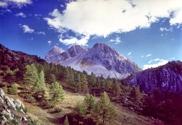
View from the Chartreuse Mountains, France

The Chartreuse Mountains (French: massif de la Chartreuse, French: [ʃaʁ.tʁøːz]) is a mountain range in southeastern France, stretching to the north from the city of Grenoble to the Lac du Bourget. It is the southernmost range in the Jura Mountains and belongs to the French Prealps.
One of the larger cities in the Chartreuse Mountains is Voiron (Isère).

Source: Wikipedia
Pic source: Link
Read More...